|
Historical Map and Source: http://www.lib.utexas.edu/maps/historical/history_world.html

Political Map Source: http://www.lib.utexas.edu/maps/historical/history_world.html

From: Miami, Florida, United States
To: San Diego, California, United States |
|
|
|
| Directions |
Distance |
Time |
| Start: Depart Start on SR-9 [SW 27th Ave] (North) |
0.7 |
0:01 |
| 1: Turn RIGHT (East) onto US-1 [S Dixie Hwy] |
1.7 |
0:03 |
| 2: Road name changes to I-95 (I-95) |
87.1 |
1:20 |
| 3: At exit 87B, take Ramp (RIGHT) onto SR-706 [W Indiantown Rd] (SR-706
/ Okeechobee) |
0.8 |
0:01 |
| 4: Turn RIGHT onto Ramp (Florida's Turnpike) |
0.2 |
< 1min |
| 5: Keep LEFT to stay on Ramp |
0.5 |
0:01 |
| 6: *Toll road* Merge onto Florida's Tpke |
192 |
2:51 |
| 7: Take Ramp onto I-75 |
108 |
1:49 |
| 8: At exit 435, turn off onto Ramp (I-10 / Jacksonville / Tallahassee) |
0.2 |
< 1min |
| 9: Take Ramp (LEFT) onto I-10 (I-10 / Tallahassee) |
115 |
1:53 |
| 10: Stay on I-10 |
330 |
5:34 |
| 11: Bridge work near Milton (SB) (November 12, 2004 - October 31, 2005) |
< 0.1 |
< 1min |
| 12: Road widening near Olive (WB) (August 11, 2003 - December 5, 2005) |
< 0.1 |
< 1min |
| Entering Alabama |
| Entering Mississippi |
| Entering Louisiana |
| 13: At exit 267A-B, take Ramp (RIGHT) onto I-12 (I-12 W / I-59 N / Hammond
/ Baton Rouge / Hattiesburg) |
85.5 |
1:26 |
| 14: At exit 1A, take Ramp (LEFT) onto I-10 (I-10) |
4.5 |
0:05 |
| 15: At exit 155B, take Ramp (LEFT) onto I-10 (I-10 / Lafayette) |
54.9 |
0:55 |
| 16: Stay on I-10 |
394 |
6:35 |
| Entering Texas |
| 17: At exit 587, turn RIGHT onto Ramp (TX-1604-LOOP / Anderson Loop
/ Randolph A.F.B.) |
0.1 |
< 1min |
| 18: Bear LEFT (West) onto E I-10 |
0.1 |
< 1min |
| 19: Turn RIGHT (North) onto SR-1604 Loop [Charles W Anderson Loop] |
25.4 |
0:23 |
| 20: Turn RIGHT onto Ramp (I-10 / US-87 / San Antonio / El Paso) |
0.1 |
< 1min |
| 21: Take Ramp (RIGHT) onto I-10 [US-87] (I-10 / US-87 / El Paso) |
63.2 |
1:02 |
| 22: Stay on I-10 |
475 |
8:00 |
| 23: At exit 18B, stay on I-10 [US-180] (West) |
375 |
5:24 |
| Entering New Mexico |
| Entering Arizona |
| 24: At exit 199, take Ramp (RIGHT) onto I-8 (I-8 / San Diego) |
185 |
2:36 |
| Entering California |
| 25: Stay on I-8 |
151 |
2:06 |
| 26: Turn RIGHT onto Ramp (CA-125 / CA-94) |
0.2 |
< 1min |
| 27: Take Ramp (LEFT) onto SR-125 (CA-125) |
2.6 |
0:03 |
| 28: Keep LEFT onto SR-94 [Martin Luther King Fwy] |
7.1 |
0:06 |
| 29: At exit 1D, turn RIGHT onto Ramp (30th Street) |
0.2 |
< 1min |
| 30: Keep RIGHT to stay on Ramp (Broadway / 30th Street) |
< 0.1 |
< 1min |
| 31: Bear RIGHT (West) onto Broadway |
2.0 |
0:03 |
| End: Arrive End |
< 0.1 |
< 1min |
| Total Route |
2663 mi |
42 hrs 19 mins | |

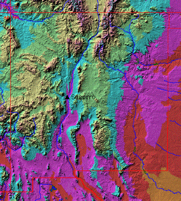
Topographical Map Source: http://www.ees.nmt.edu/Geop/pictures/nm.gif
The Historical Map show what the world was like back then it has africa connected to russia and many countries are located
diffrently from now.
The Political map shows the states of the us and the compass location with the scale
The topographical map shows the physical features of the map and the hills and mountains elevation.
If you were to travel from Miami to San diego you will have to cross 2400 miles by using a scale but might be more or
less using a traveling website directions address.
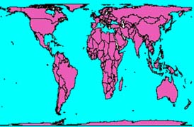
Peters projection map claim that their map is a good, fair, and non-racist view of the world.
|